An intelligent solution to prevent flood damage and protect your infrastructure. X-LEVEL accurately measures the level of rivers, streams, retention basins or any other body of water. Data is transmitted continuously via LoRaWAN and can be consulted in real time on our cloud-based platform.
Thanks to its robust sensors and long-range connectivity, X-LEVEL offers a simple, autonomous and reliable solution for monitoring water level variations and triggering alerts in the event of a sudden rise.

Introducing THE solution
Measure without moving. Save time, money and data.
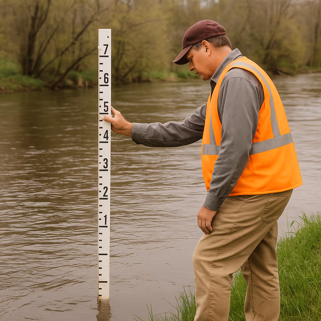
Before X-LEVEL, municipal employees had to make regular visits to river banks to manually read water levels using a graduated ruler. This process was time-consuming, risky and limited the frequency of readings.
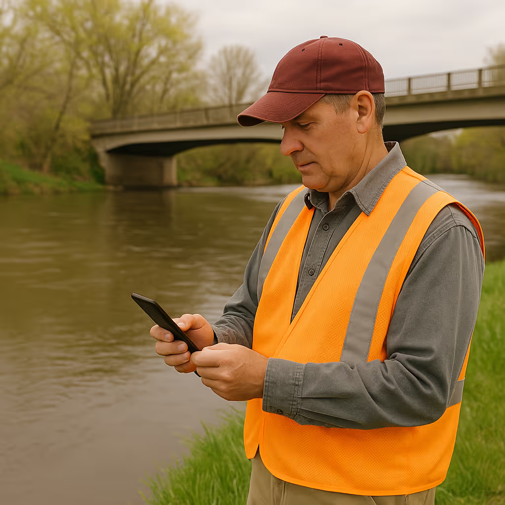
With X-LEVEL, measurements are automated, continuous and transmitted in real time via the LoRaWAN network. Teams no longer have to travel, saving hundreds of hours a year and significantly reducing operating costs.
Data is more accurate, more frequent and immediately available for analysis and decision-making - a gain that is both economic and strategic for municipal services.
With X-LEVEL, each site can be configured with thresholds tailored to its reality: normal water level, vigilance threshold, pre-alert, evacuation notice, alert or emergency.
When these thresholds are reached, the system automatically sends targeted notifications to the teams concerned - by e-mail, SMS or directly on the dashboard.
This approach creates a clear, structured action plan, where each step is triggered at the right time, avoiding arbitrary interventions and maximizing the effectiveness of the municipal response.
X-LEVEL transforms passive monitoring into proactive flood risk management.
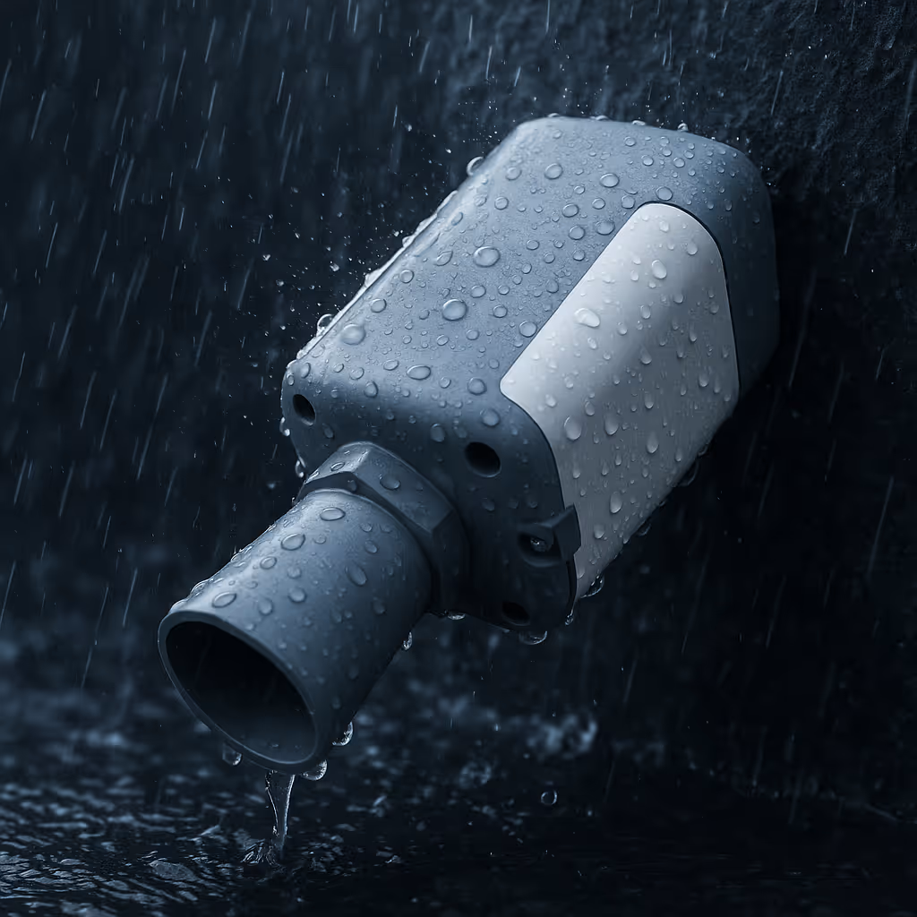
X-LEVEL sensors are designed to withstand weather, temperature variations and harsh environments. Thanks to their robust design and ultra-low power LoRaWAN communication, they offer years of maintenance-free battery life.
Even in stormy weather, icy conditions or rapidly rising waters, data transmission remains stable and reliable, ensuring continuous monitoring.
Municipal teams can therefore rely on a 100% autonomous solution, with no need for wired infrastructure or frequent intervention in the field.
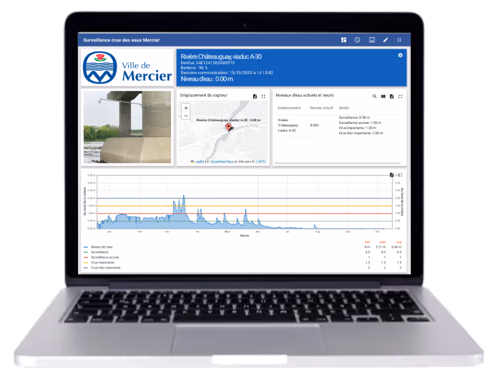
All measurements captured by X-LEVEL are automatically recorded and archived on the X-LEVEL cloud platform. Data can be visualized in the form of graphs, interactive maps or trend charts, and exported for integration into other municipal systems.
By tracking water levels over time, municipalities can better understand the behavior of watersheds, anticipate flooding episodes and adjust their warning thresholds.
This information supports the implementation of a climate change adaptation strategy, enabling risk prevention, infrastructure protection and strengthening the territory's resilience in the face of increased rainfall variability.
No infrastructure to build, no wires to run. X-LEVEL sensors can be installed in just a few minutes on bridges, embankments or retaining walls. Powered by long-life batteries, they operate completely autonomously and transmit their data via the LoRaWAN network.
The result: fast, reliable commissioning with no disruption to municipal operations.
The X-LEVEL solution now enables us to be much more proactive in our spring flood management. Thanks to the dashboard and alarms, we're really in control and leave nothing to chance.
Eric F.
Public works
City in Montreal's North Shore
Technical specifications
Precise water level measurement (ultrasonic, radar or hydrostatic pressure depending on site)
Secure LoRaWAN transmission
Automatic alerts by e-mail or SMS when thresholds are exceeded
Real-time access via X-TELIA portal (graphs, history, data export)
Extended battery life (several years on batteries, maintenance-free)
Simple, non-intrusive installation - no wiring required
See why more and more cities and utilities choose X-LEVEL to monitor spring flooding